Workshop Four
January 28, 2020
 The focus of this particular workshop was on discussing the process for creating new content for PuzzleMap aligned with teachers’ curriculum and the standards they need to teach.
Although we had a smaller group than usual, due to teachers’ schedules, the discussion was still lively.
Those able to attend enthusiastically expressed their thoughts and brainstormed ideas around the topic of creating maps that would teach different U.S. historical periods.
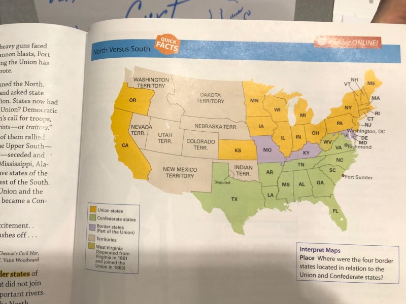
In addition, the teachers brought textbooks as resources and proposed as possibilities the following topics: Western expansion, parts of the U.S. that once belonged to Mexico, Reconstruction, the Civil War, natural resources, economics, industries, ecosystem, temperature, natural parks, religions, global civilization, local museums, the timeline of American history, railroads and transportation.
The focus of this particular workshop was on discussing the process for creating new content for PuzzleMap aligned with teachers’ curriculum and the standards they need to teach.
Although we had a smaller group than usual, due to teachers’ schedules, the discussion was still lively.
Those able to attend enthusiastically expressed their thoughts and brainstormed ideas around the topic of creating maps that would teach different U.S. historical periods.
In addition, the teachers brought textbooks as resources and proposed as possibilities the following topics: Western expansion, parts of the U.S. that once belonged to Mexico, Reconstruction, the Civil War, natural resources, economics, industries, ecosystem, temperature, natural parks, religions, global civilization, local museums, the timeline of American history, railroads and transportation.
 Sarah presented three new puzzles “in-progress” created by SpherAware, based upon the work the teachers did in December (i.e., these are new puzzles based upon a particular region and concept as requested by the teachers, but awaiting content).
These included new maps on Washington’s Ecoregions, the USA in 1776, and Native People 1776 (a map of the 13 colonies in 1776 with a base map underneath showing Native homelands during this time period).
This led to a discussion of how map-designing could involve various overlays of information on a base map of the United States with multiple topics.
Sarah presented three new puzzles “in-progress” created by SpherAware, based upon the work the teachers did in December (i.e., these are new puzzles based upon a particular region and concept as requested by the teachers, but awaiting content).
These included new maps on Washington’s Ecoregions, the USA in 1776, and Native People 1776 (a map of the 13 colonies in 1776 with a base map underneath showing Native homelands during this time period).
This led to a discussion of how map-designing could involve various overlays of information on a base map of the United States with multiple topics.
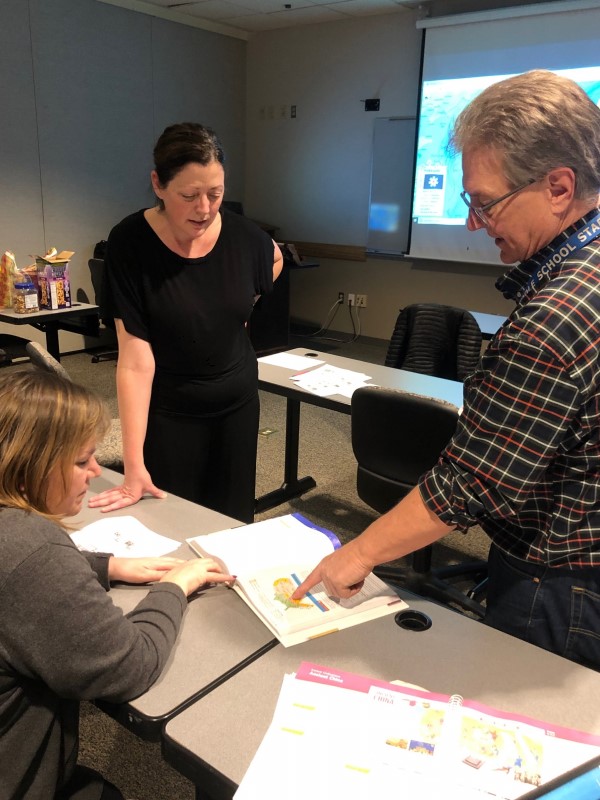
After sharing these new developments, the group discussed what the process of creating content to serve their curricular needs might look like. Sarah gave suggestions for a sequence of steps for creating Clue Windows. Everyone talked about the potential of Point Clue Teasers to entice student interest and used the Civil War as a topic with which to practice. For example, the clue window icons could be battle flags, while the categories of information could be alliance, labor, and status of slavery in the various states.
 Teachers also shared updates of the ways they’ve been using PuzzleMap in their classrooms.
Veronica shared that her third graders have been using the USA PuzzleMap to learn about the different states and to create hand-drawn post cards that share visuals and information about the state.
Laurel and Trevor have also conducted similar activities with their fourth and fifth graders.
Teachers also shared updates of the ways they’ve been using PuzzleMap in their classrooms.
Veronica shared that her third graders have been using the USA PuzzleMap to learn about the different states and to create hand-drawn post cards that share visuals and information about the state.
Laurel and Trevor have also conducted similar activities with their fourth and fifth graders.
At the end of the workshop, teachers discussed the idea of making maps on the topic of space exploration, in an effort to connect PuzzleMaps with Crystal’s language arts curriculum, and everyone enjoyed an excerpt of the video "Sentimental Journey" from the Connections TV series by James Burke which focuses on the interconnections between developments in science and technology across history and how they connect to various other discoveries, scientific achievements, and world events.
Presentation —
The Workshop 4 slides can be seen here.
Looking Ahead —
The fifth workshop, to be held on Feb. 11th, will focus specifically on creating content for the new puzzles currently in progress, with the goal of working together in groups to decide upon which images teachers desire for their respective maps, the information to be utilized in the description, and the selection of the informational categories.
Scheduling Note: —
This session was originally planned for January 14 but had to be postponed due to several schedule conflicts.
To help mitigate this problem in the future, four sessions have been planned for spring 2020 with flexibility built in for attendance.
Teachers may choose which three of the four spring workshops work best for their schedules.